The Hidden Taxes Inside Data Management
Have you ever committed to help a friend, but as the time got closer, regretted the commitment? As humans, we tend to underestimate how busy we will become as the date draws nigh and can easily overcommit ourselves.
The same concept goes for planning your projects. In particular, we tend to underestimate the time, effort and cost to create basic data for project areas as well as neglect the huge time commitment to keep them updated. Tasking your busy staff with locating, transforming, loading and updating project data can easily cost your organization thousands of unbudgeted dollars in terms of hidden costs.

Because workflows are rarely standardized, recorded and documented, these costs recur with subsequent projects. While leveraging seductive “free” data may sound like a good idea, customers often jump into data loading projects without sufficient planning and encounter huge volumes of poorly organized source data that prove difficult to subset, convert and load for your critical areas of interest.
How often have you heard a work colleague claim they could accomplish a data management task simply and quickly, only to discover that the devil was actually in the details, that the task was much more complicated and expensive to solve than first imagined, and that little thought was given to automation for updates so that the data formatting could quickly be repeated for expanded or new areas of interest?
WhiteStar has done a fantastic job recently loading three enormous “free” datasets into WhiteStar Cloud®. These include the USGS 3DEP Nationwide Contour Data the US Fish and Wildlife Service National Wetlands Data and more than 124 million building footprints for the USA from Microsoft. WhiteStar Cloud® lets you select your area of interest by county or township, choose from an extensive list of data layers, select a coordinate system and an output format. Supported output formats can be everything from a shapefile to an Esri geodatabase to an AutoCAD DWG. The data can also be directly streamed to your applications via ArcGIS web streams.
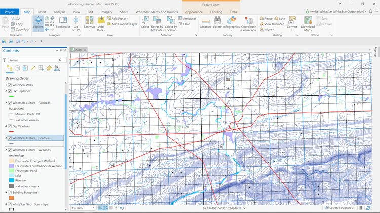
Click to enlarge image
This map shows an area in Oklahoma consisting of the new WhiteStar Culture® layers. This map was prepared in about 15 minutes using ArcGIS Pro, and overlays WhiteStar Grid® ,WhiteStar Wells® , pipelines, wetlands, and contour data (slope) for a quick overview of some of the hazards that may exist in this area.
With proper management of data, you can quickly exploit new opportunities. Data subscribers can eliminate these hidden “taxes” on your project budgets.
Robert C. White, Jr.
President and CEO
WhiteStar Corporation